Northwoods Memories Multimedia Productions
 Ordering
Pictograph Bulletins
Ordering
Pictograph Bulletins
Available Now
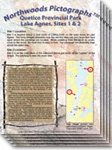
Lake Agnes, Sites 1 & 2:
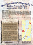
Two sites in the south end of Lake Agnes are presented in this bulletin. The first page provides directions to help you paddle directly to the sites. Pages two and three contain extensive information to help you find all the painted images at the two sites. Information about the drawings and their cultural significance is included. Page 4 explains what is known about the pigments used to paint the pictures.
Site 1 is a fairly recently discovered site on the west shore and contains four images. The site is unusual because the paintings are high above the water line. Two of the images appear incomplete as pieces of rock are missing immediately below the paintings.
Site 2 has been known for a very long time. It is a very faded image on a red colored rock. Use the photos and computer enhancements to paddle directly to the site and locate the painting easily.
Lake Agnes, Sites 3 & 4:
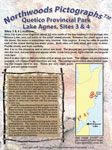
These two sites are located very close together, and are very small. Page one will help you easily locate them. Pages two and three will help you identify the images and learn about their significance. Page four is a discussion of petroglyphs, which are images chipped in rock instead of painted on rock.
Site 3 contains white images, which are unusual in canoe country.
Site 4 will introduce you to the showshoe hare, which is common in Quetico. The photos on page 3 will assist you in finding the faded images of the hares. Also included is a short discussion of the importance of the hare to the Ojibwa.
Lake Agnes, Site 5:
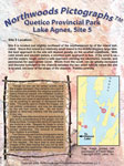
This site contains many images on one fairly large panel. The page one information will direct you to the island and the exact site. Pages 2 & 3 will help you find all of the images on the panel as well as learn of their significance. The images are spread apart and some searching is necessary to find them all. The included photographs will make this task easy.
Page four presents a discussion of the Manitous, or spirits of the Ojibwa, and their importance in the culture of the Ojibwa.
Lake Agnes, Sites 6 & 7:
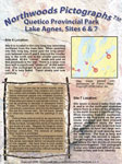
These two sites, discovered in 1992, are located in the large bay extending northeasterly from the main body of the lake. Page 1 has a map image and directions, which will help you locate the sites easily. Page 2, featuring site 6 will help you find the image and has an article on the importance of the cross to the culture. Page 3 will help you locate the site 7 image and explains some of the computer image processing used to visualize images that are hard to see. Page 4 introduces you to the different techniques used to estimate the time period during which various images were made.
Shade Lake:
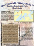
The Shade Lake site location has been incorrectly reported in many places, and many paddlers have not found it. Page one has exact directions to the site making it easy to locate.
Pages 2 & 3 contain photos and computer enhancements to make locating the images easy. The images are probably thunderbirds, and an interesting article about thunderbirds is included.
Page 4 presents the four types of medicine providers or healers most common in the societies of the Algonkian-speaking tribes of the area. Two groups of these healers are probably responsible for painting the pictograph sites in the area.
Agnes, S-Chain Set (Free Shipping):
One of the most commonly traveled loops in Quetico from Prairie Portage is the Lake Agnes, S-Chain Loop. This loop of lakes has 8 total pictograph sites described in a set of 5 Northwoods Pictographs Bulletins. You receive the following bulletins: Lake Agnes Sites 1 & 2, Lake Agnes Sites 3 & 4, Lake Agnes Site 5, Lake Agnes Sites 6 & 7, and Shade Lake. If you purchase the set, shipping is free.
A couple paddling the Agnes—S-Chain loop was the first of our clients to try Northwoods Pictograph sheets. While routing them, we asked if they were interested in pictographs. They were unexcited because they had tried unsuccessfully to find pictograph sites on a previous trip several years ago. We showed them the four pictograph sheets covering their trip and they were interested in trying them
When they returned from their trip, their first comments about their trip were that the pictograph sheets were awesome. They had used the sheets to paddle directly to the rock cliffs. They had no trouble finding the sites and all the images on each site. They said the information on the sheets was informative and interesting.
Blayne Hall
Owner of Williams and Hall Wilderness Outfitters
Keewatin Lake:
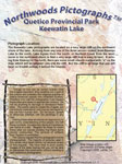
The Keewatin site contains a number of images, some clear and some quite faint. Page 1 will help you paddle directly to the site. Pages 2 & 3 contain some computer enhancements to help you find all of the images. There are short articles about the many figures present, including some abstract symbols with uncertain meanings. Page 4 is a discussion of digital image processing and computer enhancement techniques and limitations of these techniques.
Payne Lake, Ahsin Bay:
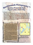
Payne Lake is a bit more difficult to access than some lakes, but once on the lake the site is easy to find. Page 1 has a map to lead you to the site along with written directions to the cliff. Pages 2 and 3 will help you find all of the images and learn a bit about them. One of the images is an interesting abstract not like any other we have seen in Canoe Country. Page 4 contains information about Grandfather Thunder, an important Manitou to the Ojibwa. Additionally, it also discusses the role of grandfathers in the Ojibwa culture. The site contains an image of a thunderbird, which is associated with grandfathers. This article is correlated with the story of Grandmother Moon, which is discussed on page 4 of the Trant Lake bulletin.
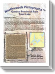
Trant Lake:
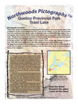
Trant Lake is not among the easiest of lakes to access. However, once on the lake the site is easy to find. Page 1 has both map and written directions to get you directly to the site. Pages 2 and 3 will help you identify all the images. One image is an interesting animal with unusual characteristics that will challenge you. Another is a hare and we have included an interesting story about hares and roses. Page 4 is an article about Grandmother Moon, who is very important in the creation tradition of the Ojibwa. It is correlated with the article on Grandfather Thunder on page 4 of the Payne Lake bulletin.
Kahshahpiwi Lake:
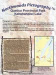
The Kahshahpiwi Lake site is on a very large cliff easily found using the map and directions on page one. Pages 2 & 3 will help you paddle directly to the two widely separated panels. In addition to the recognizable forms, several abstracts are indicated with an explanation of how we identified them among red-colored geological features. An alternative explanation to Dewdney's "sauromorph" images is presented.
With an image of a turtle at this site, it is appropriate that the page 4 article present the Turtle Manitou and its importance to the Ojibwa faith.
Hurlburt Lake and Creek Set (Free Shipping):
Paddlers traveling either Kahshahpiwi Lake or Lake Agnes, often travel this route between the two lake chains. The route has 5 total sites including many images and some most unusual images. In this set are 4 Northwoods Pictograph bulletins: Kahshahpiwi Lake (two sites), Trant Lake (one site), Payne Lake Ahsin Bay (one site), and Keewatin Lake (one site). If you purchase the set, shipping is free.
My first visit to a pictograph site was in Fishdance Lake. It was a cloudy, overcast day. It was quite mystic. I was in awe of these messages painted hundreds of years ago.
Recently I paddled solo into Lake Agnes. I took with me the Northwoods Pictographs bulletins for five sites on the lake. In my tent the night before I read every part of the material to be sure I was well informed.
I am not sure I could have found all the sites and images without the bulletins. The front-page maps made it simple to paddle near the sites. The picture from afar inside the bulletin took me directly to the rock face. Using the pictures in the bulletin I was able to easily locate every image. The text material about the images was informative and interesting. The experience left me wanting more information about the history of the sites and the meanings of the images.
Robert Edmunds DDS
Minneapolis, Minnesota
Saganaga Lake, Cache Bay (Quetico) and Seagull Lake (BWCA)
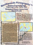
These two sites are in different countries but still fairly close together. The Sea Gull Lake site is very simple and Cache Bay is one of the most interesting sites in canoe country. Page 1 will help you locate each site. Pages 2 & 3 will help you locate what may not even be a pictograph at the Sea Gull Lake site. Also included are descriptions of the several images at the Cache Bay site. Page 4 includes a discussion of the various types of images that look like people.
Sea Gull Lake site in BWCA contains some red-colored areas that may or may not be pictographs. Listed by the Minnesota Archaeological Office and the Forrest Service as an indexed site, it is included in our series.
Cache Bay has several images including two types of human-like images, canoes, and other markings.
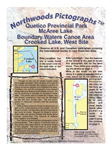
McKenzie Lake, East and West Sites:
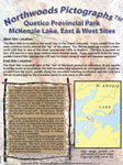
These two sites are close together in a fairly remote lake. Page one will help you paddle directly to each site. Pages 2 & 3 will help you locate small paintings on the very large cliff at the West site and find the three images on the East site, including an unusual canoe. Page 4 contains an article about the biology of lichens. The west site is on a magnificent cliff with beautiful lichens. Lichens are an important part of pictograph study as these very slow growing plants encroach upon many images, slowly destroying them.
East site contains three images, two of which are unusual for different reasons.
West site is on a magnificent cliff, beautiful in its own right, and the two small images are somewhat difficult to find.
Kawnipi Lake, McVicar Bay:
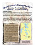
The McVicar Bay site is a bit difficult to reach, since one cannot paddle directly to the site unless water levels are quite high. Page 1 has map and written directions to the best access point to begin your walk to the site. Additionally, a point of interest is marked on the map for you to see on your way to the site. Pages 2 and 3 have an additional picture to help you find your way overland to the site. Other photos will help you identify the images and understand something of their importance. Page 3 contains information about the point of interest on your way to the site. Page 4 relates information on Beaver Manitou and the cultural importance of the beaver to the Ojibwa.
North Hegman Lake:
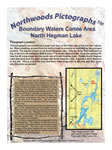
North Hegman Lake is probably the easiest site in canoe country to access. It is also one of the best known due to its very clear images. Page 1 has both a map and written directions to lead you directly to the site. Pages 2 and 3 will help you find the most widely known images as well as two images much harder to find and much less widely known. We also present via computer enhancement techniques, two small images that we do not think have been reported before. They are very challenging to find. Page 4 discusses the Maymaygwayshi, one of the "little Manitous" important to the Ojibwa. Figures that are probably Maymaygwayshi are very common on canoe country pictograph panels.
Fishdance Lake:
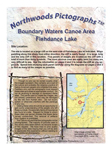
Fishdance Lake is a very commonly visited Lake in the Boundary Waters. The page 1 map image and the location description will aid paddlers in paddling directly to the cliff with the images. There are a handful of very well known images on this cliff and paddlers tend to notice them. But pages 2 and 3 clearly locate and describe the five panels of images on the cliff, several of which are easily overlooked without guidance. There are over 30 images here and each can be found using the guiding photos. Page 4 tells the story of Megis, a shell that has very important rolls in the culture of the Ojibwa. There is an image representing the Megis on this cliff site.
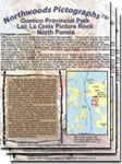
Lac La Croix Picture Rock, North Panels
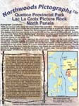
The well-known Picture Rock has six panels of images and another cliff just to the north of it has another two panels. There are so many images that these two cliffs are presented in a set of three bulletins. If you are visiting the site we recommend you purchase the three-bulletin set below.
Page one will guide you in paddling directly to the northern most or the southern most panel of this set, depending on your direction of travel. Pages 2 & 3 will lead you to the two panels on the north cliff and the first two panels on the south cliff. Following these pages you will learn about the images on these four panels. Two of the panels are well known and the other two are less well known.
The page 4 article is the first part of a three-part article explaining the creation tradition of the Ojibwa faith. Understanding the creation tradition aids in understanding many pictograph panels. The remaining two parts are on page 4 of the Middle Panels and South Panels bulletins.
Lac La Croix Picture Rock, Middle Panels
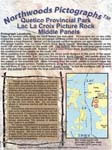
The well-known Picture Rock has six panels of images and another cliff just to the north of it has another two panels. There are so many images that these two cliffs are presented in a set of three bulletins. If you are visiting the site we recommend you purchase the three-bulletin set below.
Page one will guide you in paddling directly to the northern most or the southern most panel of this set, depending on your direction of travel. Pages 2 & 3 will lead you to the middle panels on the south cliff. Following these pages you will learn about the images on this large panel. Four images are very well known and several others are not well known, but very interesting.
The page 4 article is the second part of a three-part article explaining the creation tradition of the Ojibwa faith. Understanding the creation tradition aids in understanding many pictograph panels. The first part is on page 4 of the North Panels bulletin, and the third part is on page 4 of the South Panels bulletin.
Lac La Croix Picture Rock, South Panels
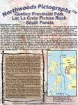
The well-known Picture Rock has six panels of images and another cliff just to the north of it has another two panels. There are so many images that these two cliffs are presented in a set of three bulletins. If you are visiting the site we recommend you purchase the three-bulletin set.
Page one will guide you in paddling directly to the northern most or the southern most panel of this set, depending on your direction of travel. Pages 2 & 3 will lead you to the two panels at the south end of the south cliff. Following these pages, you will learn about the images on these two panels, the "warrior panel" and the "handprint panel."
The page 4 article is the third part of a three-part article explaining the creation tradition of the Ojibwa faith. Understanding the creation tradition aids in understanding many pictograph panels. The first two parts are on pages 4 of the North Panels and Middle Panels bulletins.
Lac La Croix Picture Rock, Three-Bulletin Set
The well-known Picture Rock has six panels of images and another cliff just to the north of it has another two panels. There are so many images that these two cliffs are presented in a set of three bulletins. If you are visiting the site we recommend you purchase the three-bulletin set.
You will receive Lac La Croix Picture Rock, North Panels
Lac La Croix Picture Rock, Middle Panels
and Lac La Croix Picture Rock, South Panels.
For information about these three bulletins, see the above descriptions.
McAree Lake (Quetico) and Crooked Lake West (BWCA)
These two sites are in lakes on opposite sides of the international border, but they are close together and many paddlers visit both sites in a single canoe trip. The page 1 map images with location descriptions aid in finding the sites. All paddlers must obey both U.S. and Canadian laws in crossing the border. Page 2 describes the very simple and easily overlooked site in McAree Lake. Without knowledge of the location of the site and its image, most paddlers traveling by it probably overlook it. Also on this page is presented a point of interest that may or may not be a pictograph. Visitors should observe it and decide for themselves. Page 3 presents the images from the site in the far West end of Crooked Lake near Curtain Falls. One of the figures is a very unusual human image not like any other in the area. Page 4 discusses the importance of clans to the Ojibwa and the clan totems, or symbols, which appear in many pictograph panels in canoe country.
Darkwater Lake, East and West Sites
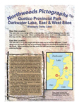
Darkwater Lake, formerly known as Darky Lake, has two sites with very interesting images. The page 1 map image and directions will make finding the sites easy. Page 2 will help paddlers find and understand the west site. One unusual images of a human figure may have been “overpainted” based on the photographic evidence presented. Page 3 describes all three panels of images on the East site. These are some of the best-known images in Quetico for various reasons presented in the narrative. One panel is very faded and seems to be very old. The other panels are very bright, perhaps newer, and have interesting stories to tell. Page 4 introduces the reader to Ginebik, an evil spirit from Ojibwa culture.
Lac La Croix East Area Set (Free Shipping)
Many paddlers traveling in the east end of Lac La Croix also paddle into the set of lakes north of Curtain Falls. While the set of many images at the Lac La Croix Picture Rock make the trip worthwhile, McAree Lake, Darkwater Lake, and Crooked Lake also have pictograph sites.
Included in this set are five Northwoods Pictograph Bulletins: the three bulletin Lac La Croix Picture Rock set, McAree Lake and Crooked Lake West (two sites), and Darkwater Lake (two sites).
If you purchase the set, shipping is free.
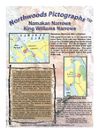
Namakan Narrows and King Williams Narrows
These two sites near Crane Lake have unusual situations. The map images and descriptions on page 1 assist in locating the sites. Since both sites are outside both Quetico and the Boundary Waters, motorboats are common in the area and the sites can be quickly reached by motorboat from Crane Lake. Pages 2 and 3 tell the very interesting story of the Namakan Narrows site including the story of the “missing rock” from this area. Northwoods Memories obtained photos of the missing rock and they have been included. White pictographs can be seen here. They are rare in canoe country. Page 4 presents the King Williams Narrows site, which is much better known for the geologic “face” on the rock than for the pictographs. Many visitors who look at the face are not even aware the pictographs exist. With the help of the page 4 photos, both the face and the pictographs can be located.